
Did you know that every continent has a different world map? Well, the continents are pretty much the same but the way they are portrayed are different. Some examples?


 The ancient Hellenes also made world maps. Land ownership and geography was changed mainly according to new rulers and natural disasters, such as earthquakes and volcanoes, and of course the ancient Hellenes didn't exactly have the grasp on geography we have today. Here are some of the major maps of Ancient Hellas:


European:
United States:
Canada:
Asia:
And my favourite, Australia:
Anaximander (c. 610 – c. 546 BC)
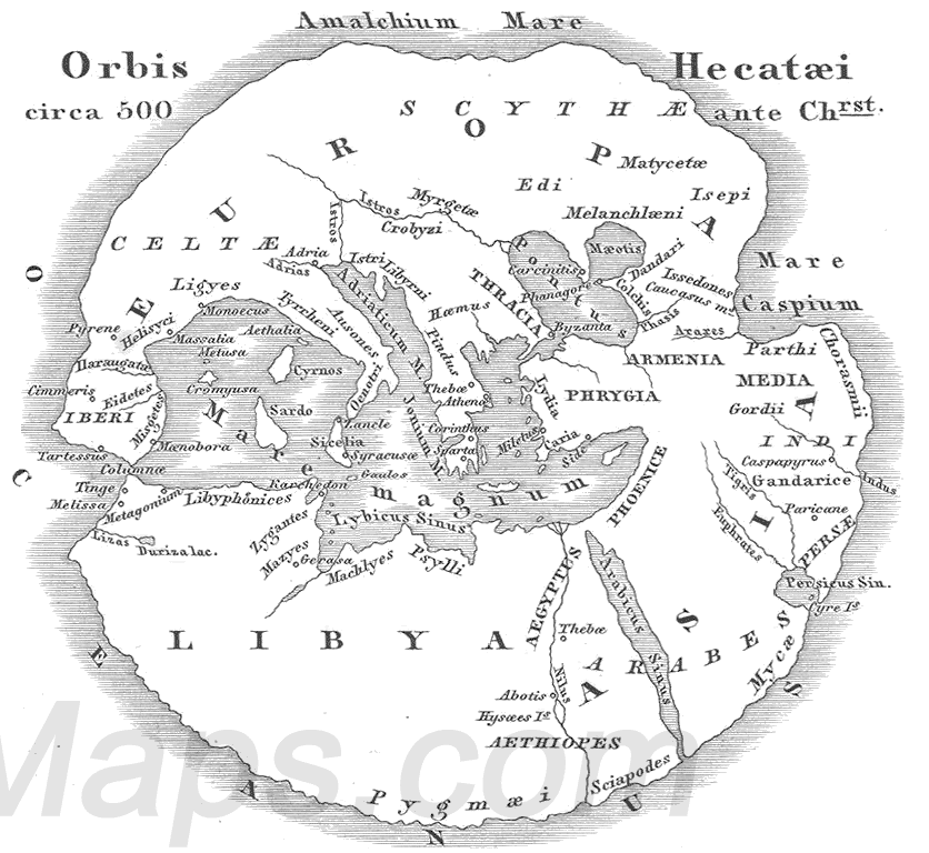
Hecataeus of Miletus (c. 550 BC – c. 476 BC)
Eratosthenes (276 – 194 BC)
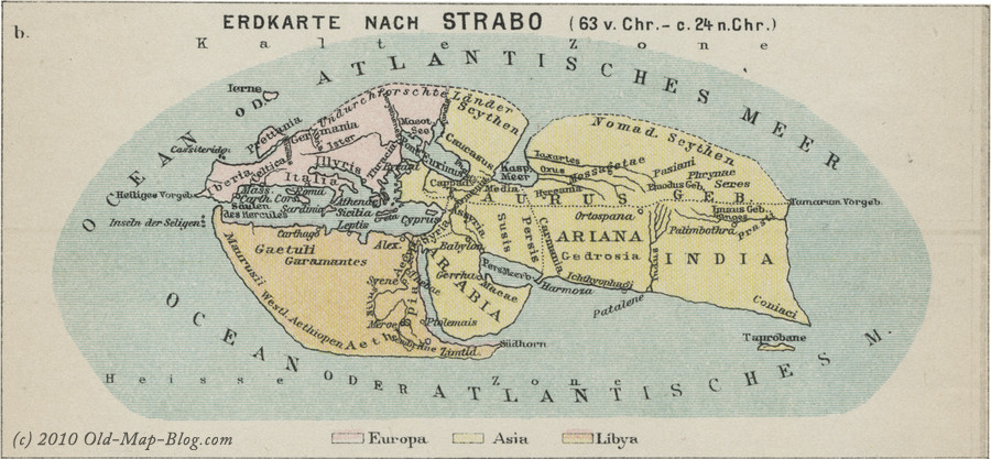
Strabo (64/63 BC – c. 24 AD)
As you can see, not entirely accurate but very amusing--and it worked for them. These maps helped along trade and travel, brought perspective to the world and pushed the art of geography forward. Most of these are reconstructed maps based on descriptions as the original work has been lost, but they are still brilliant to behond.
-
Tuesday, January 27, 2015
Anaximander ancient Hellenic culture current affairs Eratosthenes Hecataeus of Miletus Strabo
1 comment:
First: Australia's is my favourite, as well.
Next: I don't know that I've ever seen that "American" map. Usually it's like the "Canadian" map, but with the Arctic Longitudinal squashing seen in the "European."
Lastly: There's an xkcd for that.
http://xkcd.com/977/
Post a Comment