Showing posts with label Ancient Cities Collection. Show all posts

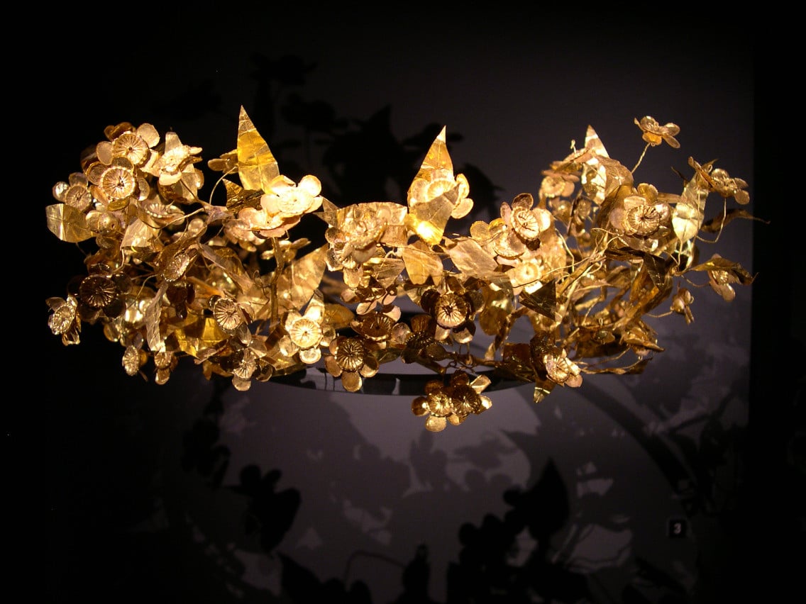
In Somerset, England, a British pensioner who wishes to remain anonymous found a 2,300-year-old ancient Hellenic crown packed up in some crumpled up newspapers in an old cardboard box under his bed. According to Daily Mail, which interviewed the man, he had had many possessions left to him by his grandfather, who was a seasoned world traveler and collector.

“I inherited quite a lot of things from him and I just put this to one side for almost a decade and didn’t really think anything of it.”

He took the golden crown, along with some other items, to be appraised by a nearby auction house, Duke’s of Dorchester, about five years ago. It was there that the crown was discovered by one of the appraisers, Guy Schwinge; he described that unforgettable moment to the Daily Mail. 

“When the owner pulled the gold wreath from a tatty cardboard box filled with paper, my heart missed a beat. When I went to the cottage the last thing I expected to see was a piece of gold from antiquity.”

The handmade crown, made of pure gold, is approximately eight inches across and weighs about 100 grams (about 11 ounces, less than one pound). The rare find surprised both the owner as well as the appraiser.

“I knew my grandfather traveled extensively in the 1940s and 50s and he spent time in the northwest frontier area, where Alexander the Great was, so it’s possible he got it while he was there. But he never told me anything about this wreath.”

The mystery, therefore, will remain.

The crown is believed to be from antiquity in Northern Greece, dating as far back as the Hellenistic period, which took place from the death of Alexander the Great in 323 BC and the emergence of the Roman Empire at the Battle of Actium in 31 BC. It has been reported that the crown is worth as much as £100,000 to £200,000.

It is not easy to trace the exact lineage of the crown since it has no paper trail or documents, but because it was found with traces of dirt, it is believed that it may have been buried at some point in time.

“It is notoriously difficult to date gold wreaths of this type. Stylistically it belongs to a rarefied group of wreaths datable to the Hellenistic period and the form may indicate that it was made in Northern Greece.”

Crowns such as the one discovered usually depicted branches of laurel, myrtle, oak and olive trees, all symbolic of the ideals and morals held in ancient Hellas such as wisdom, triumph, fertility, peace and virtue.

The crowns, which are extraordinarily fragile, were typically worn on special occasions or dedicated to the gods and placed as offerings at the graves of aristocratic people in ancient times.

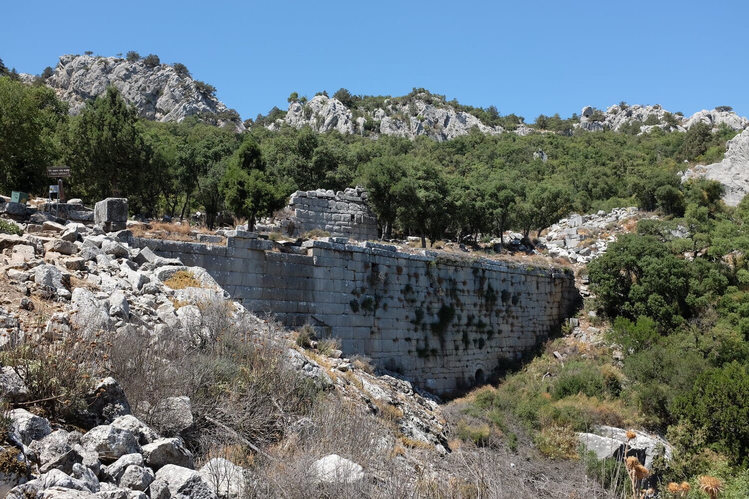
Termessos was a fortified city, founded by Pamphylian tribes called the Solymi (also called the Solims) near the peak of the Solymos (Güllük Dağı) mountain, in the Taurus mountain range in present-day Turkey. According to the Greek philosopher and historian Strabo, the Solymi derived their name from Solymeus, an Anatolian God who was later identified with Zeus, giving rise to the cult of Zeus Solymeus.

Little is known about the historical context of Termessos, but the earliest encounter with the city comes from text called the Anabis of Alexander by Arrian of Nicomedia, who describes the conquests of Alexander the Great. In the Anabis, Alexander surrounded Termessos in 333 BC, where Alexander likened the city to an “eagle’s nest”, failing to take the city.

An inscription found in the Lycian city of Araxa gives the next mention of Termessos, citing a war with the league of Lycian cities in the 2nd century BC, and again in conflict with its Pisidian neighbour Isinda.

In 71 BC, Termessos allied with Rome and was granted independent status, ensuring the freedoms of its citizens to have autonomy (documented in the minting of coins which bear the title “Autonomous”). Rome’s influence is apparent within the city’s monuments that show elements of Greek and Roman architectural features, and with the construction of a triumphal arch in dedication to the Emperor Hadrian.

At its peak, Termessos had an estimated population of 150,000 inhabitants, with the city consisting of a royal palace, a gymnasium, an odeon, six temples of varying sizes, an agora, a bouleuterion (council house), and a theatre with a seating capacity of some 4-5,000 spectators. To the south, west and north of the city, mostly within the city walls, there are large cemeteries containing rock-cut tombs.

Termessos, after a gradual decline, was abandoned in the 5th century AD, when an earthquake destroyed the primary aqueduct cutting off vital water to the inhabitants.

In the field of economics, the concept of a market economy is largely considered a modern phenomenon. Influential economists such as Karl Marx and Max Weber, for example, argued that although markets existed in antiquity, economies in which structures of production and distribution responded to the laws of supply and demand developed only as recently as the 19th century. A recent study by an international team of researchers, including Adam Izdebski of the Max Planck Institute for the Science of Human History, uses palynology - the study of pollen remains extracted from cored sediments - to challenge this belief and provide evidence for an integrated market economy existing in ancient Hellas.

Using publicly available data from the European Pollen Database, as well as data from other investigators, researchers analyzed pollen assemblages from 115 samples taken from six sites in southern Greece to measure landscape change. 

Using radiocarbon dating to tie their measurements to historical time, researchers followed the change in percentage values for individual plant taxa between 1000 BCE and 600 CE and observed a decrease in pollen from cereals, a staple of the ancient Greek diet, during a period of apparent population growth. 

This decrease occurred at the same time as an increase in the proportion of olive and vine pollen. These trends raise an important question: why would local producers chose to plant olives and vines instead of cereal grains, when the demand for this staple food must have been high and mounting?

In the current study, researchers argue that pollen data from southern Greece reveals an export economy based on cash cropping as early as the Archaic period, primarily through olive cultivation. Although archaeological evidence from these periods documents the movement of goods, quantifiable data on market integration and structural changes in agricultural production have been very limited. "In this paper," says lead author Adam Izdebski, "we introduce pollen records as a new source of quantitative data in ancient economic history."

Before arriving at their conclusions, researchers compared the trends they observed in the pollen data with three other sources of data in an instance of pioneering scientific research. 

First, researchers observed a decrease in pollen from uncultivated landscapes corresponding with each increase in settlement numbers. This correlation between the number of settlements and the exploitation of the land supports the methodology of the study and indicates the potential of palynology for future studies in a variety of scientific disciplines.

Researchers then looked for evidence of increased trade activity in Mediterranean shipwrecks, which are routinely used to estimate maritime trade and overall economic activity. After restricting their search to wrecks from the appropriate period and region, scientists observed trends in shipwrecks consistent with trends found in cereal, olive, and vine pollen. Both sources of data suggest an economic boom in the 1st and 2nd century CE, a decline in the 4th and 5th century, and a smaller boom in the 6th century.

Finally, researchers examined trends in the presence of large-scale oil and wine presses in the Mediterranean. The presence of these machines, although not located in Greece, indicates a pattern of broad economic trends in the region and changing incentives for the production of large quantities of olive oil and wine. Again, the researchers found that trends in archaeological findings of oil and wine presses were consistent with trends in cereal, olive, and vine pollen.

As the emergence of integrated markets and capitalist economies of the early modern era is believed to have been at the roots of the Anthropocene, the current epoch in which humanity has become a major geological force, the current study shows that the structural developments that occurred on a large scale through European colonization from the 15th century onward were possible several thousand years before.

The findings are published in The Economic Journal.

Already in antiquity he was viewed as a model: Homer. His epics, "The Iliad" and "The Odyssey" are still timely even after 2700 years – or is it 2800 years? The precise dating of his epics is until now just as controversial as is the question of whether the poet actually existed. The former question may now be modified. The reason: a formerly unequalled precision in the chronology, based on new C14-dates, calls into question the previously accepted Greek periodisation system.


An international research project under the directorship of Stefanos Gimatzidis of the Austrian Archaeological Institute of the Austrian Academy of Sciences (ÖAW) reaches this conclusion. The findings necessitate a radical revision of Greek chronology: according to these results, important historical events, as well as the origin of numerous innovations in philosophy, literature and political organisation ought to be dated 50 to 150 years earlier. The study is now published in the American professional journal PLOS ONE.

In collaboration with Bernhard Weninger from the Institute for Prehistory and Ancient History of the University of Cologne, for the first time the Greek historical time grid has been reassessed using modern scientific methods, namely, with precise radiocarbon dates. To this end, sample materials were employed which originate from well-dated contexts from the northern Aegean archaeological site of Sindos.

The site is of archaeological interest for a number of reasons, amongst them the presence of numerous imported pottery vessels from a variety of regions of Greece, enabling a comparison and a correlation of the regional systems of chronology. Thanks to the extensive continuous stratigraphy, the archaeological method of determining the age of deposits, a reliable statistical modelling of the radiocarbon dates is also now possible. ÖAW archaeologist Stefanos Gimatzidis states:

"Frequently the application of the method of C14-dating suffered from the difficulty that the high measurement accuracy actually achieved from the C14 laboratory cannot be used at all in archaeological practice."

This statistical fluctuation range is the – initially unavoidable – result of actual fluctuations in the atmospheric concentration of C14:

"Thus, in archaeology one regularly has many very precise C14 measurements at hand, all of which however, after correcting for the fluctuations of the atmospheric C14 concentration, unfortunately only provide a long list of possible datings, typically with a variance within the scope of 100 to 300 years."

The current study now profits from a completely unusual situation, virtually a double stroke of luck: on the one hand, the C14 calibration curve in the evaluation of the C14-dates from Sindos offers from the outset an unusually high chronological precision that, in the second place, could be even more strongly reinforced by means of the targeted extraction of well-dated animal bone samples from an uncommonly long profile with settlement levels of the Early Iron Age.

"Thus the advantages of the method in this case complement each other, to the benefit of a dating precision which for this period has until now not been achieved," 

With the aid of the combination of radiocarbon dates and pottery, chronological errors could now be significantly reduced. Gimatzidis says:

"Often, natural sciences and the humanities have been viewed as opposites. In our work they complement each other."

For him, one thing is certain: the new findings bring about not only the redating of individual events or finds, they suggest a new reading of ancient history. One can now conceive of the dissemination of the alphabet or the symposium in Greece and Italy as a longer process which began in the 9th century BC. The archaeologist states:

"To the same time period could also be dated the conception of the Homeric epics, to which some verses on a drinking vessel from Pithecoussai on Ischia indicate, as well as the start of Greek colonisation, which at the same time, together with the Phoenician expansion, increased the globalisation of the Mediterranean." 
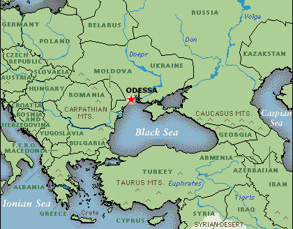
Many people--myself included--sometimes forget how extensive the ancient Hellenic empire was. It wasn't just what is now modern Greece. It extended all the way down to, for example, Ukraine. Today: Odessos.


Odessos (Οδησσος), which is the modern day Odessa, is one of the oldest settlements in Bulgaria. It was found during the last quarter of 6th century BC (about 585–550 BC) by Hellenic immigrants from the Asia Minor city of Miletos. They came upon the site of an earlier settlement by Thracians, which name the ancient immigrants preserved.

During its first two centuries of existence, to about the middle of the 4th century BC, Odessos was an important harbor on the Black sea western coast. Its citizen traded with numerous cities and islands of Hellas and Asia Minor, from where they imported luxurious objects: painted ceramics, gold, marble, as well as amphorae with wine and olive oil, and many similar edible or general use objects. Part of the imported items stayed in the city while another part was exchanged or traded with Thracians from the internal parts of the city’s region with whom the Odessians had excellent relations throughout their stay. In return, the Thracians sold to Odessos grain, meat, wood and other raw materials for the city to export.

Odessos, until this point in time, was a wealthy city but not a large one. Around the middle of the 4th century BC Odessos was fortified with seige walls in the hopes of withstanding the attacks of Phillip II of Macedonia in 339 BC. Their efforts succeeded but Phillip II's son, Alexander III the Great (336–323 BC) conquered the city in 335 BC.

Odessos flourished most during the Hellenistic Age (end of third to first century BC), when the city served as temporary center for the armies of the Thracian heir of Alexander the Great, king Lesmachus (323–280 BC). From the second half of the 4th century BC, Odessos started its own mint house. Local coins were illustrated with the head of city’s chief deities: Appollon and the so-called 'Great God'. Other deities were honored as well: Dionysos, Demeter and various Samothracian deities. During this time, large public buildings like theatres, temples and gymnasia were constructed during the period. Due to the increase of Thracian population in the city a temple for the Thracian God-rider Heros Carabazmos was erected  in second to first century BC, as well as a temple of Artemis Phosphoros.

In 15 AD Odessos became part of the Roman Empire as part of the province Moesia (later Moesia Inferior) and served as its main port. The city remained relatively independant and retained the right to mint its own bronze coins to the middle of the third century AD. Over the coming centuries, the city flourished and remained a major hub of import for marble, gold, precious stones for its jewelry workshops, glass, bronze utensils, luxurious ceramics, wine and other unavailable locally items. Local craftsmen produced ceramic, glass and bronze utensils, lamps, gold and silver jewelry, architectural ornaments. Arts were very popular – theater, music and poetry. Bronze and marble statues were erected. New cults appeared – to the Emperor in Rome, to the health related deities Asclepius and Hyggia, to the eastern god Mithras. Very popular were sports and gladiator fights. Each five years traditional sport and cultural events took place.

Christianity's influence expanded gradually but Odessos preserved the old cults prevailed well until 5th century AD. During that period the city turned into one of the most important commercial centers of early Byzantine Empire. It became the seat of a bishop. By the end of 6th and early 7th century Avar and Slav intrusions depopulated and ruined the lands between the Haemus (Balkan mountains) and the Danube river. Gradually these territories were left to barbarians from the Byzantine officials. Odessos still remained the most solid ground for ancient civilization and traditions and it was one of tha last cities to fall into barbarian hands. In 614 AD its inhabitants left it, the city overrun and ruined by barbarians and left without population for a number of centuries.

In the Middle Ages successive rulers of the Odessan region included various nomadic tribes, the Golden Horde, the Crimean Khanate, the Grand Duchy of Lithuania, and the Ottoman Empire. During the Russian-Turkish War of 1787–1792, Russian forces took the city for the Russian Empire. In 1819, the city became a free port, a status it retained until 1859. Following the Bolshevik Revolution in 1917, during the Ukrainian-Soviet War, the city then known as 'Odessa' became a center of the Odessa Soviet Republic. In 1991, when Ukraine gained its independence from the Soviet Union in the aftermath of its dissolution at the end of the Cold War, Odessa became part of the Ukraine.
The ancient Hellenic city of Thouria, located in the southern Peloponnese, is among the cities which managed to thrive and become important centers all by themselves in the wider region, despite being under the shadow of nearby super-powers (in this case Sparta).


Located on the outskirts of the modern-day city of Kalamata in the county of Messenia, Thouria was at its peak of development during the classical period of ancient Greece. Incredibly, however, the existence of its ancient ruins was not even known until the first decade of the 21st century.

An archaeological dig in 2007 led experts to the discovery of an entire city, which appeared to have been an important hub during ancient times. Archaeologists originally unearthed a temple and an Asclepeion, a type of temple devoted to healing found all across the ancient Hellenic world.

Approximately three years ago, archaeologists unearthed a large part of the ancient theater of the city of Thouria, adding much more information to what we already knew about this polis. The theater, which dates back to the 4th century BC, came to light during these excavations, which took place in the summer of 2016.

More discoveries were on tap for the archaeological dig season of 2017, when archaeologists uncovered the perimeter of the theater’s orchestra and several rows of stone seats. The orchestra’s perimeter, which is 16.3 meters (53 feet) long, has three parallel grooves around it, which suggest that its stage was movable.

The city of Thouria was mentioned by both Pausanias and Strabo, two of ancient Greece’s most famous geographers. Thouria’s ancient theater is oriented toward the west, overlooking the vast plains of Messenia, known in ancient times as “Makaria,” meaning the “blessed and blissful land.”

In the distance, to the southwest, one can see the beautiful sea of the Messenian Gulf, which ancient Helenics were called “Thouriates,” most likely due to the city of Thouria.

Archaeological works continue to this day in Thouria, where archaeological students from around the world come to practice their profession and learn more about their science and this important ancient Greek region.

A small town bearing the name of Thouria, with a population of approximately 3,000 people, exists to this very day near the ancient ruins. A town that links together thousands of years of Greek history in this beautiful southern corner of Greece.

Images of the site here.
The site of the ancient city of Oeniadae, in the regional unit of Aetolia-Acarnania in Greece, boasts one of the best preserved shipyards of the antiquity. An important city in the antiquity, Oeniadae used to have three ports, strong fortifications and a large theatre. Its well-preserved ruins make it a monument of great interest to this day.


Oeniadae was an ancient city of southern Acarnania on the northern bank of the Achelous River; the river, stretching from Aeolia (modern Thessaly) to the Ionian Sea, forms a natural boundary between what used to be the ancient regions of Acarnania and Aetolia. Oeniadae was Acarnania’s second most important city after Stratos. Its position allowed it to control the entrance to the Gulf of Patras; surrounded by marshes, it was naturally barricaded, while strong additional fortifications were built to protect it. Its position was also favourable for the development of commercial activities, as well as for shipbuilding.

Its name appears linked to the mythical Oeneus, king of Calydon; according to the myth, its founder was the Argive leader Alcmaeon, who fled there pursued by the Furies for having committed matricide. Many historians place its founding in the sixth century BC, as a Corinthian colony. While in the early years of the Peloponnesian War the city was hostile to Athens, in 424 BC it joined the Athenian Alliance and served as a base for the Athenian warships.

It continued to be a place of importance during the Macedonian and Roman wars. In the time of Alexander the Great, the Aetolians, who had extended their dominions on the west bank of the Achelous, obtained possession of Oeniadae and expelled its inhabitants.
The city remained in their hands until 219 BC, when it was taken by Philip V of Macedonia who strongly fortified the citadel, and commenced uniting the harbour and the arsenal with the citadel by means of walls. In 211 BC it was taken by the Romans under Marcus Valerius Laevinus, and given to the Aetolians, who were then their allies; in 189 BCE it was finally restored to the Acarnanians by virtue of one of the conditions of the peace made between the Romans and Aetolians in that year. Thereafter, progressive silting of its harbours diminished the city’s usefulness.

The remains of the ancient city are located on a flat-topped hill, over the surrounding alluvial plain, which used to be a marshland in the ancient times. Since the medieval times, the site’s name has been Trikardo or Trikardokastro. The walls of the ancient city, built along the brow of the hill in a polygonal style, are still well preserved, while the port and shipyards are protected by separate fortifications. Inside the central fortification we find public buildings, forming part of the Agora, as well as private buildings, a small temple close to the port and a bath complex. No signs of medieval occupation of the site exist. The modern-day municipal unit Oiniades, of the Missolonghi municipality, was named after the ancient town of Oeniadae.

Oinades had three different ports. The fortified port, which also featured a shipyard and ship sheds, is one of the best preserved from the antiquity. It was used for hauling and repairing ships and storing them in the winter months. It was a roofed structure, with its floor carved into the rock, divided by five colonnades. This served as a tow ramp. The site was in full operation until the 3rd century BC when the roof receded and the colonnades collapsed.

The city’s largest harbour, used for commerce, was on the southwest side of the hill, near the large central gate of the city, with easier access to Achelous River, while a third smaller port also used to exist.

The site of Oinades also features a theatre, which was built close to the Agora, with with great acoustics and panoramic views of the Achelous River and the coastal lowlands.
The theatre was constructed in two separate phases: it was built when the Athenians occupied the city, in the 4th century BC, with a one-storey stage and a particularly large orchestra.
In the 3rd century, reconstruction operations were carried out, possibly by the Macedonian king Philip V. Among other alterations, a foreground was added, as well as an additional storey for the stage. Its capacity reached 4,600 spectators. The theatre is open to the public, and concerts and plays are held every summer as part of the Oeniades Festival, held by the Messolonghi municipality.
Visitors to New York, London, Athens and other cities often flock to museums to view their collections of priceless Hellenic pottery dating from the BCE period. What visitors don’t see are the many other pottery fragments that lie, broken and forlorn, in the museums’ storerooms. Some of these fragments are the work of unscrupulous art dealers, who deliberately shattered small vases and urns and used the sherds to repair larger, more valuable pieces.

Danielle Smotherman Bennett has ambitions to bring those pottery shards into the light with a digital archive that would eventually contain tens of thousands of 3-D models of sherds from museums around the world. Together with existing digital information on intact Hellenicpottery, such an archive could expand our knowledge of the ancient world, Bennett said.

An expert on Hellenic vase painting, Bennett joined San Diego State University this fall. She is the first to be appointed to the Friends of Classics and Barbara Schuch Endowed Postdoctoral Fellowship in Classics and Digital Humanities.

Bennett’s office in the Arts and Letters Building is decorated with reproductions of Helleic pottery from the seventh to fourth centuries BCE. Most are the work of artisans from Corinth, Greece, where Bennett was field director for excavations directed by the American School of Classical Studies at Athens in the 2016 season while finishing up her Ph.D. in Classical and Near Eastern archaeology from Bryn Mawr College.

One of the less elaborately decorated pieces in her office is Bennett’s own work—an attempt to replicate an olpe jug. Her interest in ancient Hellenic pottery extends to the manufacturing techniques that gave these pieces unusual endurance.

"These objects are beautiful but also functional. We can appreciate them now, centuries later, because they are more durable than baskets of wood and even metal. The plain ones were, to the Greeks, similar to what Tupperware is to us. I like that tangible aspect."

Bennett’s research also charts the changes in Hellenic vase painting over time. Beginning in the  fifth century BCE, she said, there is a dramatic increase in women as subjects. Most are depicted performing daily tasks such as food preparation. The shift could reflect a change in the target market, as many men were absent from Athens while fighting wars.

Currently leading a seminar on how to use technology and digital resources to research the ancient world, Bennett will teach World Mythology with an emphasis on mythological imagery in spring 2019. 

Bennett is also scheduled to present the 49th Annual Gail Burnett Lecture in the Classics at 3 p.m. on Wednesday, Dec. 5, in room 201 of the Arts and Letters Building. Her lecture will examine three Athenian vase paintings dating between 525-460 BCE that feature the mythological sisters Philomela and Procne best known from Ovid’s “Metamorphoses.”
Many people--myself included--sometimes forget how extensive the ancient Hellenic empire was. It wasn't just what is now modern Greece. It extended all the way down to, for example, Turkey. Today: Lagina (and Stratonkeia).


Just a few kilometers away from modern day Yatağan in Turkey are the ruins of the ancient city of Lagina (Λαγίνα), which is famous for its Hekate Sanctuary. The establishment of the sanctuary at Lagina as a religious center dates back to the Seleucids but evidence from the necropolis implies that the origins of the settlement go back to the 7th century BC. Seleucid kings conducted a considerable reconstruction effort in the sacred ground of Lagina and transformed it into a foremost religious center of its time, with the nearby (at a distance of 11 kilometers) site of Stratonikeia becoming the administrative center. The sites of Lagina and Stratonkeia were connected to each other in antiquity by an 11 km long road called the Sacred Way (ceremonial road).

The sanctuary consisted in its center of the famous Temple of Hekate. It was bordered by a wide temenos (the sacred area around a temple) surrounded by a stoa (a covered walkway) in the Doric order. The entrance was a propylaea (monumental gateway) with a semicircular colonnade at the front. A stairway with ten steps led from the propylaea to a paved way and then to the altar.

The Temple of Hekate, dated to the last quarter of the 2nd century AD, measured 21m x 28m and was built in the Corinthian order with 8 columns on its shorter sides and 11 columns on its longer sides. A frieze covered all four sides of the building. The reliefs are exhibited in the Istanbul Archaeology Museums and bear representations from the Greek and Carian (the ancient inhabitants of Caria in southwest Anatolia) mythology; scenes from the life of Zeus could be seen on the eastern frieze, the Gigantomachy (a battle between the Gods and giants) on the western frieze; on the southern frieze a gathering of Carian gods, and on the northern frieze the Amazonomachy, a battle between the Amazons and the Greeks.

Numerous festivals were celebrated at the site during which a procession delivered the key of the temple from Lagina to the bouleuterion in Stratonkeia on which the rules of the religious celebrations of Hekate were written.
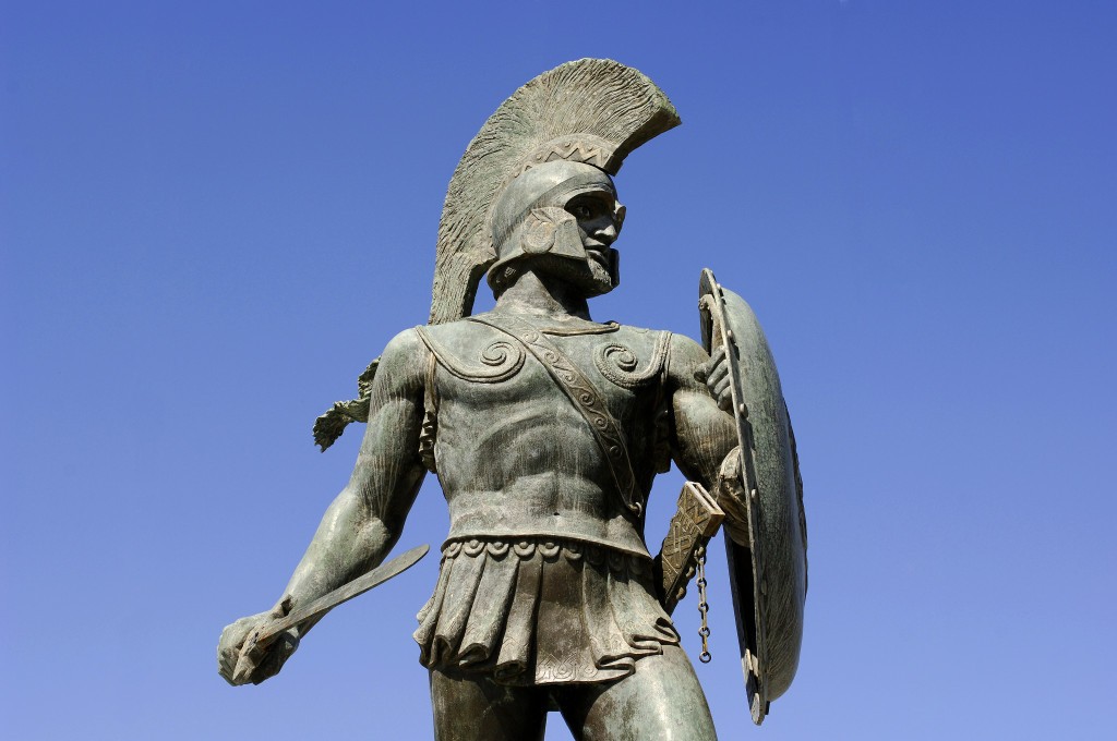
To this day, Spartans are seen as the toughest SOB's of the ancient Hellenic world--and they were! The physical (and often intellectual) prowess of both Spartan men and Spartan women outdid that of those of any other Polis. Why? Because every minute of a young Spartan's life--right up to adulthood--was taken up with becoming the best adult they could be.


Spartan youngsters faced their first obstacle the second they were born: their father. If their father found a birth defect or otherwise rejected the child, he or she was literally left to the wolves. A child deemed worth raising was raised by its mother until it was seven years old, but boys accompanied their father to the syssitia (τὰ συσσίτια, tà sussítia, dining clubs) where he would sit on the floor and learned what it was like to be a Spartan man through watching and listening.

The laws of Sparta were developed and written by Lycurgus, a legendary lawmaker who, in the 7th century BC reorganized the political and social structure of the polis, transforming it into a strictly disciplined and collective society. He also developed the stringent military academy of the agoge (ἀγωγή, agōgē), where Spartan boys were trained from childhood to adulthood in three stages: the paídes (about ages 7–17), the paidískoi (ages 17–19), and the hēbōntes (ages 20–29).

Lycurgus instituted the practice of appointing a state officer, the paidonomos (παιδονόμος, paidonómos, boy-herder) who organized the boys into divisions of about 60 each called agelai (ἀγέλαι, agélai, herds). These were groups of peers of the same age. Most of their time was spent in this compan. The agelai were under the supervision of an eiren (εíρήν, young adult) aged about 20, at whose house the agelai ate.

Children went barefoot to encourage them to move swiftly, and they are encouraged to learn to withstand the elements by having only one outfit. They were never satiated with food or fed fancy dishes. If the boys wanted more food, they went on hunts or raids. Their stealing was not only allowed but encouraged--but if they got caght, they suffered floggings. If they made a sound during their punishment, they were flogged again. From Plutarch's Life of Lycurgus comes this little titbit:

"The boys make such a serious matter of their stealing, that one of them, as the story goes, who was carrying concealed under his cloak a young fox which he had stolen, suffered the animal to tear out his bowels with its teeth and claws, and died rather than have his theft detected." [18.1]

During the day, the boys played ball games, and learned to ride and swim. They studied dance as a kind of gymnastic training for war dances as for wrestling. This was so central that Sparta was known as a dancing place from Homeric times. It is not clear whether they learned to read; Sparta abhorred written records and laws, and prided themselves on not needing them. After dinner, the boys sang songs of war, studied history, and discussed morality with the eiren. He also quizzed them, trained their memory, logic, and ability to speak laconically. They slept on reeds.

And what of Sparta's girls? The law reforms of Lycurgus also included certain rules and allowances for them. Spartan women were seen as the vehicle by which Sparta constantly advanced. Unlike many other ancient Hellenic girls, they were afforded formal education as well, although it seems they lied at home with their mothers instead of being into room and board like the boys. They also could not use their education to have careers or earn money.

Spartan girls were forbidden from wearing any kind of makeup or enhancements. The girls would exercise outdoors, unclothed, like the Spartan boys, which was impossible in the rest of the ancient Hellenic world. They also participated in athletics, competing in events like footraces.

Giving Spartan girls a physical (and mental) education was seen as a guarantee that the strong and fit Spartan women would reproduce, and when they had babies, those babies would be strong warriors in the making. I note the mental aspect because Spartan women of all ages mingled, in public, with Spartan men. Through these meetings, they learned many of the intellectual pursuits of the men and the ancient Spartan women were infamous for their ability to trade conversation and give political commentary. They were known for their razor-sharp wit and outspoken natures.

Their methods worked: Around 650 BC, Sparta rose to become the dominant military land-power in ancient Hellas and held that position for almost 300 years.
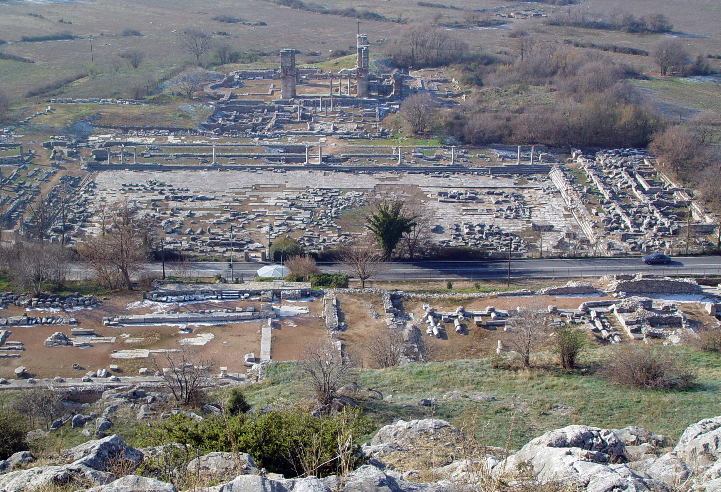
Greece is issuing a circulating commemorative €2 coin to celebrate the ancient settlement of Philippi. A total of 750,000 of the coins are due for release in the second half of 2017. So what's this settlement and why is it important enough to feature on a coin?


Philippi, or Philippoi (Φίλιπποι) was a city in eastern Macedonia, in the Edonis region. Its original name was Krenides (Κρηνῖδες), meaning "Fountains". It was establishment by Thasian colonists in 360/359 BC. The city was renamed by Philip II of Macedon in 356 BC and would eventually be abandoned in the 14th century after the Ottoman conquest. It was made a World Heritage Site in 2016.

The objective of conquering the town was to take control of the neighboring gold mines and to establish a garrison at a strategic passage: the site controlled the route between Amphipolis and Neapolis, part of the great royal route which crosses Macedonia from the east to the west and which was reconstructed later by the Roman Empire as the Via Egnatia. Philip II endowed the city with important fortifications, which partially blocked the passage between the swamp and Mt. Orbelos, and sent colonists to occupy it. Philip also had the marsh partially drained, as is attested by the writer Theophrastus. Philippi preserved its autonomy within the kingdom of Macedon and had its own political institutions (the Assembly of the demos). The discovery of new gold mines near the city, at Asyla, contributed to the wealth of the kingdom and Philip established a mint there. The city was fully integrated into the kingdom under Philip V. The city contained 2,000 people at the height of it Hellenic era. The most important (Hellenic and Roman) monuments of the site are:

The walls and the acropolis: The structure has two architectural phases: the first was built by Philip II and the second by Justinian I in A.D. 527-565. Inside the acropolis there is a tower dated to the Late Byzantine period.

The theatre, which was probably built by king Philip II around the middle of the 4th century B.C. In the 2nd and 3rd centuries it was overhauled to meet the demand in .

The Agora was the administrative center of Philippi in the Roman period. It is a complex of public buildings arranged around a central open square. The most imposing buildings are the North-East temple and the North-West temple.

Basilica A is a large, three-aisled basilica (130 x 50 meter) with transept aisle on the east side, a square atrium, and gallery over the aisles and the narthex. Fragments of the luxurious pavement and part of the ambo are preserved in the middle aisle. Particularly impressive are the frescoes that imitate orthostates (dados) in the porch of a chapel. Dated to the end of the 5th century A.D.

Basilica B is a three-aisled basilica dated to ca. 550 A.D. It has a narthex and annexes to the north and south (phiale, vestry). The almost square in plan, central aisle was covered with a vault supported by large pillars. This is the basilica portrayed on the coin.

Basilica C is another three-aisled basilica. It had luxurious marble inlays on the floor and rich sculptural and architectural decoration. The basilica is dated to the 6th century A.D.

The excavations on the site of Philippi began in 1914 by the French School of Archaeology at Athens. After the Second World War, excavations were resumed by the Greek Archaeological Service and the Archaeological Society. Nowadays, the archaeological exploitation of the site is carried out by the Archaeological Service, the Aristoteleian University of Thessaloniki and the French School of Archaeology at Athens. The finds from the excavations are housed in the Museum of Philippi.

An image of the archaeological site featuring part of Basilica B, and linear motifs inspired by a border pattern from an ancient Greek mosaic discovered at the site, appears on the obverse of the coin. Inscribed along the inner circle are Greek inscriptions translating to “Archaeological Site of Philippi” and “Hellenic Republic.” Also inscribed in the background is the year of issuance 2017 and to the right a palmette (the Mint mark of the Greek Mint). Visible at the lower left is the monogram of the artist, George Stamatopoulos.
Many people--myself included--sometimes forget how extensive the ancient Hellenic empire was. It wasn't just what is now modern Greece. It extended all the way down to, for example, Russia, Italy, Spain and the Ukraine. But, of course, there were ancient Hellenic cities in modern day Greece too that no longer exist today. One of these is Mieza.

[Can't find it? Little left and below of center,
under "Bottia"]

At the foot of mount Vermio in Central Macedonia, Greece, excavations brought to light and continue to reveal the remains of an ancient city, which is identified with Mieza, one of the major cities of the Macedonian kingdom the period of its prosperity (4th to 2nd century BC). There are numerous references for Mieza at ancient literary sources, most notably Plutarch's information that near the ancient city lay Nymphaion, in the shady paths of which Aristotle taught the young Alexander the Great.

[Excavations of the "Aristotle School" near Naousa]

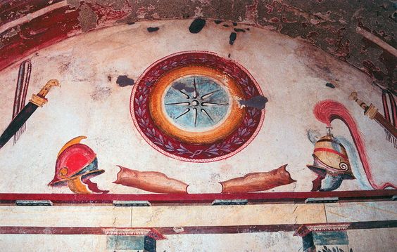
Mieza was a rural community that transformed into an urban center, then into a prosperous and wealthy city of the Hellenistic period. The most valuable archaeological evidence derives from the cemeteries and burial monuments of the area, which preserved the second most significant complex of Macedonian tombs after the royal tombs of Vergina. A total of six Macedonian tombs were found along the course of the road that in antiquity led from Pella to Mieza. They bear all the typical features of the monumental Macedonian tombs, they namely are subterranean vaulted structures with a temple-like façade and one or two burial chambers. Most often the internal surfaces, as well as the façade bear painted decoration and it is noteworthy that the murals of the Macedonian tombs are so far the only preserved examples of the large-scale ancient Greek painting. The tombs used to be covered with soil to form a hill and formed the resting places of the royal dynasty.

[Facade of the "Tomb of Judgment"]

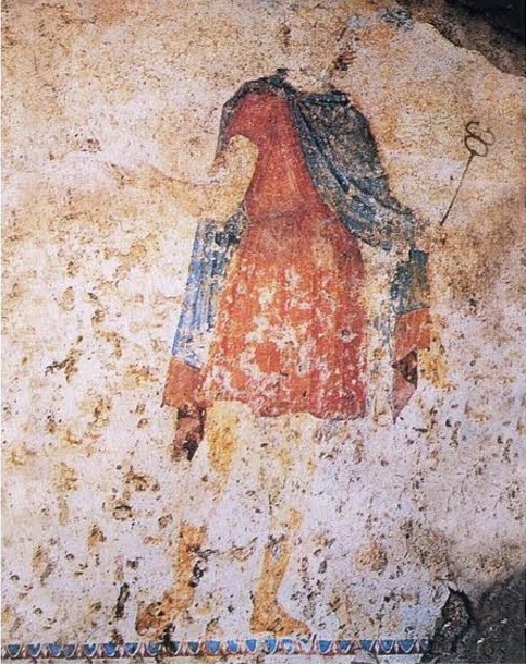
Perhaps the most important amongst all known Macedonian tombs is the Tomb of Judgement (late 4th - early 3rd century BC), one of the largest and most imposing monuments of its kind. Unique is the exterior of the tomb articulated by a two-storey façade which combines the Doric order in the lower half and the Ionic in the upper half respectively. Among the Doric half-columns flanking the door of the tomb are four paintings, depicting Hermes Psychopompos leading the dead to the Judges of the Underworld. The Doric metopes depict scenes of the Kentauromakhy while the war scene of the Ionic frieze with its relief figures represents one of the historic battles of Greeks and Persians.

[Fresco from the Tomb of Judgment showing Hermes Psychopompos]

Outside the perimeter of the ancient city, along the contemporary rural road that leads from Kopanos to Naoussa, lies the idyllic site of Isvoria. The lush landscape with the plenty waters and natural caves on the rocks was an ideal place for worshipping the Nymphs in antiquity. The scattered architectural parts of a rock-hewn Ionic stoa, dated after the mid-4rth century BC, were associated with the ancient descriptions and led to the identification of a significant site: the very school of Aristotles, where the young prince Alexander studied under the great philosopher.

[Painting from the Tomb of Lyson and Kallikles (2nd BC)]

The ancient city itself consists of disperse building complexes, though its boundaries cannot yet be delineated with precision. The architectural remains belong mainly to buildings of a public character and it’s most likely that the nucleus of the ancient city, namely its agora, lay at the present rural site of Belovina at Kopanos, where the theatre also came to light. The theatre dates to the Late Hellenistic period, though the form in which it is preserved today belongs to the Roman times. It was built on a hillside with a panoramic view over the valley and its capacity is estimated at 1500 spectators. The prosperity of Mieza is also reflected in the luxurious villas of the Hellenistic and Roman times. Among the best preserved examples are the two Roman villas at Tsifliki of Lefkadia and Baltaneto of Naoussa respectively, with splendid mosaic floors dated to the 2nd century AD.
Many people--myself included--sometimes forget how extensive the ancient Hellenic empire was. It wasn't just what is now modern Greece. It extended all the way down to, for example, Russia, Italy, Spain and the Ukraine. But, of course, there were ancient Hellenic cities in modern day Greece too that no longer exist today. One of these is Rhamnous.


Rhamnous (Ραμνούς), also Ramnous or Rhamnus or Rhamnounda, was a remote Attic deme center on a small sheltered bay along the rocky north-eastern Attic coast. It was named for the local prickly bush called ramnos and was the most important sanctuary of Nemesis in ancient Hellas.

Rhamnous was strategically important because it overlooked a narrow stretch of the Euboean channel. After Athens lost the city of Dekelia in 412 B.C., it also became important as the main harbor for import of food supplies from Euboea. The deme center at Rhamnous was fortified in the 5th or 4th century B.C. and probably received a permanent garrison because of its strategic position.

The temple of Nemesis in Rhamnous was renowned even before the fortified settlement acquired importance in the 5th century BC. Rhamnous also had a cult of Themis. A temple smaller and earlier than the temple of Nemesis, build around 480 BC may have been dedicated to both Gods. The later temple (ca. 420 BC) was dedicated to Nemesis alone, but was left unfinished. The worship of Nemesis ended in 382 BC when the Byzantine emperor Arcadius ordered that all pagan temples be destroyed.

The hamlet at Rhamnous also had a gymnasium and a small theater which may have served for civic assemblies as well as performances. Within the town's fortifications a hill top was enclosed in a second circuit of walls and may have held a permanent Athenian garrison. A route led from the town, through the necropolis and up to the Sanctuary of Nemesis and Themis situated on an artificial terrace facing the sea. The temenos was entered from the south-east and contained two small, closely adjacent temples and a number of sculptures and dedications.


For images and artist's impressions of the city, temples and sites, please go here.
Many people--myself included--sometimes forget how extensive the ancient Hellenic empire was. It wasn't just what is now modern Greece. It extended all the way down to, for example, Syria. Today: Hippos.


Hippos (Ἵππος) is an archaeological site in Israel, located on a flat-topped foothill 2 kilometres (1.2 mi) east of and 350 metres (1,150 ft) above the Sea of Galilae. The site is just on the Israeli side of the 1949 UN-demarcated border between Syria and Israel, near modern Kibbutz Ein Gev.

Between the 3rd century BC and the 7th century AD, Hippos was the site of a Graeco-Roman city, which then declined under Muslim rule and was abandoned after an earthquake in 749. Besides the fortified city itself, Hippos controlled two port facilities on the lake and an area of the surrounding countryside. Hippos was part of the Decapolis, or Ten Cities, a region in Roman Jordan, Syria and Israel that were culturally tied more closely to Hellas and Rome than to the Semitic ethnoi around.

Established as Antioch of Hippos (Ἀντιόχεια τοῦ Ἵππου) by Seleucid settlers, the city is named after the Greek language word for horse, Hippos, and a common name of Seleucid monarchs, Antiochus. The Seleucis Empire, by the way, was a Hellenistic state ruled by the Seleucid dynasty, which existed from 312 BC to 63 BC; it was founded by Seleucus I Nicator following the division of the Macedonian empire vastly expanded by Alexander the Great.The Aramaic name, Sussita (Hebrew: סוסיתא‎‎), was also adopted into Hebrew and also means horse, while the Arabic name, Qal'at al-Hisn, means 'Fortress of the Horse/Stallion'. Other names include the alternate spelling Hippus and the Latinized version of the Greek name: Hippum. The precise reason why the city received this name is unknown.

Excavations in Hippos have revealed traces of habitation from as early as the Neolithic period. The site was again inhabited in the third century BC by the Ptolemies, though whether it was an urban settlement or a military outpost is still unknown. During this time, Coele-Syria served as the battleground between two dynasties descending from captains of Alexander the Great, the Ptolemies and the Seleucids. It is likely that Hippos, on a very defensible site along the border lines of the 3rd century BC, was founded as a border fortress for the Ptolemies. The city of Hippos was most likely established in the middle of the second century BC.

As the Seleucids took possession of all of Coele-Syria, Hippos grew into a full-fledged polis, a city-state with control over the surrounding countryside. Antiochia Hippos was improved with all the makings of an Hellenic polis: a temple, a central market area, and other public structures. The availability of water limited the size of Hellenistic Hippos. The citizens relied on rain-collecting cisterns for all their water; this kept the city from supporting a very large population.

Hellas' rule did not last. The Maccabean revolt resulted in an independent Jewish kingdom under the Hasmonean dynasty in 142 BC. In c. 83-80 BC, Alexander Jannaeus led a Hasmonean campaign to conquer lands east of the Jordan River.

In 63 BC the Roman general Pompey conquered Coele-Syria, including Judea, and ended Hasmonean independence. Pompey granted self-rule to roughly ten ten cities on Coele-Syria's eastern frontier; this group, of which Hippos was one, came to be called the Decapolis and was incorporated into the Roman Provincia Syria. Under Roman rule, Hippos was granted a certain degree of autonomy. The city minted its own coins, stamped with the image of a horse in honor of the city's name.

Its rule exchanged hands several more times before the Romans created the province of Palaestina in 135, of which Hippos was a part. This was the beginning of Hippos' greatest period of prosperity and growth. It was rebuilt along a grid pattern, centered around a long decumanus maximus running east-west through the city. The streets were lined with hundreds of red granite columns imported from Egypt. The great expense required to haul these columns to Palestine and up the hill is proof of the city's wealth. Other improvements included a Kalybe (a shrine to the Emperor), a theatre, an odeon, a basilica, and new city walls. The most important improvement, however, was the aqueduct, which led water into Hippos from springs in the Golan Heights, 50 km away. The water, collected in a large, vaulted cistern, allowed a large population to live in the city.

When Christianity became officially tolerated in the Roman Empire, Palestine became the target of Imperial subsidies for churches and monasteries, and Christian pilgrims brought additional revenue. Industry expanded and more luxury goods became available to common people. Christianity came slowly to Hippos. There is no evidence of any Christian presence before the 4th century. A Byzantine-era pagan tomb of a man named Hermes has been found just outside the city walls, attesting to the relatively late presence of pre-Christian religions here. Gradually, however, the city was Christianized, becoming the seat of a bishop by at least 359. One Bishop Peter of Hippos is listed in surviving records of church councils in 359 and 362.

The Muslim armies of the Rashidun period invaded Palestine in the 7th century, completing their conquest by 641. Hippos' new Arab rulers allowed the citizens to continue practicing Christianity, a policy then continued by the Umayyad Caliphate. However, the population and economy continued to decline. The earthquake of 749 destroyed Hippos and it was abandoned permanently.

Archaeological surveys were conducted here in the late 19th C by Gottlieb Schumacher. During the early 50s there were clashes on this border, and the IDF fortified the Sussita hill as a front post. This is an archaeologist's dream--the ruins were mostly undisturbed, and the treasures found under the debris are fascinating. However, it will take years to complete this enormous task of excavation, reconstruction and preservation.
Many people--myself included--sometimes forget how extensive the ancient Hellenic empire was. It wasn't just what is now modern Greece. It extended all the way to, for example, the Ukraine. Today: Chersonesos.


Chersonesos (Χερσόνησος, Khersonesos) is an ancient Hellenic colony founded in the 6th century BC and is located on the shore of the Black Sea at the outskirts of Sevastopol on the Crimean Peninsula, where it is referred to as 'Khersones'. The name 'Chersonesos' in Greek means 'peninsula', and aptly describes the site on which the colony was established. It was sometimes combined with supplemental monikers to denote its location, as in Tauric Chersonesos (that is, in the land of the Taurian tribes) found in the work of the author Arrian. It should not be confused with the Tauric Chersonese itself as that name often applied to the whole of the southern Crimea.

In Ancient Hellas, colonies were sometimes founded by vanquished people, who left their homes to escape subjection at the hand of a foreign enemy; sometimes as a sequel to civil disorders, when the losers in internecine battles left to form a new city elsewhere; sometimes to get rid of surplus population, and thereby to avoid internal convulsions; and sometimes as a result of ostracism. But in most cases the motivation was to establish and facilitate relations of trade with foreign countries and further the wealth of the Hellenic metropolis--mother country.

The exact time of and circumstances surrounding the foundation of Chersonesos remain highly spculative. Information about the initial period of the history of the polis is isolated and fragmentary. The earliest reference dating to the mid 4th century BC is found in the Periplous by Pseudo-Skilakes in which Chersonesos is referred to as a trading city.

Chersonesos was founded by Dorians from Heraklea Pontica (present-day Eregli, Turkey) significantly later than the majority of Greek cities in the northern Black Sea region. The territory was previously inhabited by the Taurians, a tribe less readily competent to establish close ties with the Greeks than other aboriginal inhabitants of Crimea. These factors influenced both the subsequent history of Chersonesos and its governmental structure.

Chersonesos remained a relatively small city until approximately the middle of the 4th century BC. It can be surmised that Greek maritime transit trade constituted a significant part of the city's earliest economy. Chersonesos, as the northern Black Sea city in closest proximity to the Pontis, lay in an extremely auspicious location on naval trade routes. All ships traveling from the southern Black Sea coast or from Greece to the northern Black Sea region crossed the Pontis Euxine (Black Sea) and stopped at Chersonesos en route to their destinations. But the advantages of this location did not become apparent until the early 4th century BC at which time the ancient Hellenes began to use the direct route from Sinope across the Black Sea to Chersonesos. According to numismatic evidence, the role of Chersonesos as a leading transit point for maritime trade continued into later periods.

The situation in the city begins to change in the 4th century B.C. The development of the Heraklean Peninsula begins with the appearance of the first large military-industrial settlement in the second quarter of the century at so-called Lighthouse Point, ten kilometers from Chersonesos. In contemporary scholarship this area is named Strabo's Old Chersonesos. It is probable that in the second half of the 4th century BC Chersonesos encompassed the rest of the Heraklean Peninsula, the territory which becomes the agricultural basis of the polis until the end of its existence. It may be that because this was a condition specific to many Dorian polises the development of the Heraklean Peninsula resulted in the expulsion and/or perhaps enforced submission of a part of the local Taurian population.

Around the beginning of the 4th century BC began the expansion of Chersonesos into the fertile plains of northwestern Crimea, a consequence of which was the subordination of Kerkinitis and the economic development of a wide agricultural territory in the second half of the century. Many fortresses and unfortified settlements were built, while land was divided into plots. The precise progression of events connected with the territorial expansion of Chersonesos is not clear, although the process of expansion may have occurred militarily, especially if this phenomenon collided with the interests of the Scythians and perhaps even Olbia, with whom Kerkinitis was closely tied.

The transformation of Chersonesos into a formidable state entity with extensive land holdings and a well-developed agricultural infrastructure based on the production of grapes and grain raised it to the level of a leading Black Sea polis. The height of economic and cultural development in Chersonesos occurs in the second half of the 4th-3rd century BC and is well-documented in the archaeological results of the ancient city.

During much of the classical period Chersonesus was a democracy ruled by a group of elected archons and a council called the Demiurgi. As time passed the government grew more oligarchic, with power concentrated in the hands of the archons. A form of oath sworn by all the citizens since the 3rd century BC has survived to the present day:

"I swear by Zeus, Gaia, Helios, the Virgin (Parthenos), the Olympian gods and goddesses, and the heroes who protect the city and territory and fortified places of the Chersonesitans: I will co-operate to defend the safety and freedom of the city and the citizens, and I will not betray Chersonesos or Kerkinitis or Kalos Limen or any other fortified town or other places which the Chersonesitans inhabit or have inhabited, to anyone either Greek or barbarian, but I will protect them for the people of Chersonesos. I will not abolish the democracy, nor will I support or conceal anyone who plans to betray or abolish the democracy, but I will report them to the damiourgoi in the city. I will be the enemy of anyone who plots against or betrays or foments revolt in Chersonesos or Kerkinitis or Kalos Limen or the fortified places and territory of the Chersonesitans. I will give the best and fairest practical assistance and advice to the city and the citizens. I will preserve the (?) safety {sastēr} of the people, and I will not reveal any secrets to anyone, Greek or barbarian, which could cause harm to the city. I will not give or receive any gift for the sake of harming the city and the citizens, nor will I plot any evil deed against any of the citizens, unless they are in revolt; nor will I support or conceal anyone who plots such things, but I will report them and vote against them according to the laws. I will not join any conspiracy against the state of Chersonesos nor against any of the citizens unless they have been declared to be enemies of the people. If I have joined any conspiracy or if I have been bound by any oath or curse, if I put an end to it may it turn out well for myself and my kin, but if I abide by it, may the opposite occur. If I detect any conspiracy that already exists, or is being formed, I will report it to the damiourgoi. I will not give away corn to be removed from the plain, nor will I take it anywhere else away from the plain, except to Chersonesos. By Zeus and Gaia and Helios and the Virgin and the Olympian gods, if I abide by this oath, may it turn out well for myself and my family and my associates, but if I do not abide by it, may it turn out badly for myself and my family and my associates; may neither the land nor the sea bear fruit for me; may my women fail to bear any children . . . "

Already in the 3rd century BC a general shake-up took place in the military-political situation of the northern Black Sea region. From the very beginning Chersonesos co-existed with various belligerent tribes and peoples, among them the Taurians and Scythians, against whom the city had to defend itself countless times, both defensively and offensively during its territorial expansion.

In the first third of the century the majority of settlements in the chora of Chersonesos succumbed to the invasions. This situation may possibly be connected to the growing abilities of the Scythians, or what is more probable, the Sarmatian incursion into the Don-Dnipro region. Archaeological evidence points to the fact that Chersonesos entered the 2nd century B.C. in a weakened state, and consequently was subject to the power of stronger political and economic shocks.

After the appearance of the Scythian state with its capital in Neapolis in the 3rd century BC, the Scythians increased their pressure on Chersonesos. Scythian fortified settlements were built dangerously close to the city of Chersonesos. The city's lack of a military force capable of withstanding the Scythians resulted in its search for allies. In 179 BC Chersonesos concluded a treaty with Pontic king Pharnakes I, who pledged his assistance in any struggles against the Scythians. In the late 2nd century BC renewed Scythian pressure on Chersonesos forced the city to apply to King Mithradates VI Eupator, the grandson of Pharnakes I, for aid. This petition established the beginning of a new stage in the political history of the northern Black Sea region. Mithradates' intervention saved Chersonesos from the Scythian danger, although the city lost its political independence in the process and, together with Bosporos, joined the Pontic State of Mithridates .

After Rome subdued the kingdom of Mithradates VI Eupator, Chersonesos found itself subordinate to Bosporos and remained so until Julius Caesar granted the city its independence in 46-45 B.C. After Caesar's death the Bosporan king Asandros attempted to subordinate Chersonesos once again, but the city successfully retained its independence. Around 25-24 BC Augustus normalized relations between the Chersonesan civil community and the Bosporan dynasts. Under the initiative of the Roman administration, Bosporos and Chersonesos created a defensive union which existed until war broke out between Rome and Bosporos. Chersonesos joined the side of Rome during the war, after which Chersonesos was granted certain privileges. Throughout this period Chersonesos maintained a Roman garrison an thrived.

In the period spanning from the first centuries AD to the advent of Christianity the worldview of the population of Chersonesos developed in two related, but at the same time alternate, directions. In the first, the cults of Hellenistic deities were still popular. All the deities retained their traditional functions, attributes, and symbols. As in the past, the main cult was that of the city's patroness, Parthenos (Maiden). In addition, the cults of many Olympic Gods received special attention. Historical factors, such as the strengthening of ties with the Roman Empire, influenced the selection of deity worship according to Roman taste, and Roman emperors occasionally chose to cultivate the most popular Hellenistic deities, such as Aphrodite, Apollo, and Asklepios, according to the needs of their policy.

Chersonesos became a Byzantine possession during the Early Middle Ages and withstood a siege by the Göktürks in 581. Byzantine rule was slight: there was a small imperial garrison more for the town's protection than for its control. It was useful to Byzantium in two ways: as an observation point to watch the barbarian tribes, and its isolation made it a popular place of exile for those who angered the Roman and later Byzantine governments. After the Fourth Crusade (1202–04), Chersonesus became dependent on the Byzantine Empire of Trebizond, and then fell under Genoese control in the early 13th century. In 1299, the town was sacked by the Mongol armies of Nogai Khan's Golden Horde.

Chersonesus' ancient ruins are presently located in one of Sevastopol's suburbs. They were excavated by the Russian government, starting from 1827. The buildings mix influences of Greek, Roman and Byzantine culture. The defensive wall was approximately 3.5 kilometres (2.2 mi) long, 3.5 to 4 metres wide and 8 to 10 metres high with towers at a height of 10 to 12 metres. The walls enclosed an area of about 30 hectares (74 acres). Buildings include a Roman amphitheatre and a Greek temple.
The surrounding land under the control of the city, the chora, consists of several square kilometres of ancient but now barren farmland, with remains of wine presses and defensive towers. According to archaeologists, the evidence suggests that the locals were paid to do the farm work instead of being enslaved.

The excavated tombstones hint at burial practices that were different from the Greek ones. Each stone marks the tomb of an individual, instead of the whole family and the decorations include only objects like sashes and weapons, instead of burial statues. Over half of the tombs archaeologists have found have bones of children. Burned remnants suggest that the city was plundered and destroyed. The site is now part of the National Preserve of Tauric Chersonesos. In 2013, Chersonesus was listed as a World Heritage Site.
Many people--myself included--sometimes forget how extensive the ancient Hellenic empire was. It wasn't just what is now modern Greece. It extended all the way to, for example, Italy. Today: Akragas.


The ancient Hellenic city of Akragas (Ἀκράγας)  was one of the leading cities of Magna Graecia during the golden age of Ancient Hellas. It was founded on a plateau overlooking the sea, with two nearby rivers, the Hypsas and the Akragas, and a ridge to the north offering a degree of natural fortification. Its establishment took place around 582-580 BC and is attributed to Hellenic colonists from Gela, who named it. Gela (Γέλα), was and is a town and comune on the south coast of Sicily, Italy. It, in turn, was founded by Hellenic colonists from Rhodes and Krete in 689 BC. Aeschylus lived here and died here as well, in 456 BC.

After its establishment, Akragas grew rapidly. It became one of the richest and most famous of the Hellenic colonies of Magna Graecia, the name of the coastal areas of Southern Italy on the Tarentine Gulf that were extensively populated by Hellenic settlers. It came to prominence under the 6th century tyrants Phalaris and Theron and became a democracy after the overthrow of Theron's son Thrasydaeus. At this point the city could have been as large as 100,000 - 200,000 inhabitants.

Although the city remained neutral in the conflict between Athens and Syracuse, its democracy was overthrown when the city was sacked by the Carthaginians in 406 BC. Akragas never fully recovered its former status, though it revived to some extent under Timoleon in the latter part of the 4th century.
The Romans laid siege to the city in 262 BC and captured it after defeating a Carthaginian relief force in 261 BC and sold the population into slavery.

Although the Carthaginians recaptured the city in 255 BC, the final peace settlement gave Punic Sicily and with it Akragas to Rome. It suffered badly during the Second Punic War (218-201 BC) when both Rome and Carthage fought to control it. The Romans eventually captured Akragas in 210 BC and renamed it Agrigentum, although it remained a largely Greek-speaking community for centuries thereafter. It became prosperous again under Roman rule and its inhabitants received full Roman citizenship following the death of Julius Caesar in 44 BC.

Currently it's named 'Agrigento' and it's a major tourist centre due to its extraordinarily rich archaeological legacy. Ancient Akragas covers a huge area, much of which is still unexcavated today. The archaeological focus is on the famous 'Valle dei Templi' (Valley of the Temples:, which is not a valley at all but a ridge. It's comprised of a large sacred area on the south side of the ancient city where seven monumental Hellenic temples in the Doric style were constructed during the 6th and 5th centuries BC. Now excavated and partially restored, they constitute some of the largest and best-preserved ancient Hellenic buildings outside of Greece itself. They are listed as a World Heritage Site.
The Valley includes remains of seven temples. All were namedn of the named in Renaissance times, apart from the the Olympeion. The temples are:
- the Temple of Concordia, whose name comes from a Latin inscription found nearby, and which was built in the 5th century BC. It was turned into a church in the 6th century AD and is now one of the best preserved in the Valley.
- the Temple of Juno, also built in the 5th century BC. It was burnt in 406 BC by the Carthaginians.
- the Temple of Herakles, who was one of the most venerated deities in ancient Akragas. It is the most ancient in the Valley. It was destroyed by an earthquake and today it consists of only eight columns.
- the Temple of Olympian Zeus, built in 480 BC to celebrate the city-state's victory over Carthage.
- Temple of Kastor and Pollux of which only four columns (famously) remain
- the Temple of Vulcan, also dating from the 5th century BC. It is thought to have been one of the most imposing constructions in the valley; it is now however one of the most eroded.
- the Temple of Asklepius, located far from the ancient town's walls.

For images of these ancient sites, go here.
Many people--myself included--sometimes forget how extensive the ancient Hellenic empire was. It wasn't just what is now modern Greece. It extended all the way down to, for example, Ukraine. Today: Odessos.


Odessos (Οδησσος), which is the modern day Odessa, is one of the oldest settlements in Bulgaria. It was found during the last quarter of 6th century BC (about 585–550 BC) by Hellenic immigrants from the Asia Minor city of Miletos. They came upon the site of an earlier settlement by Thracians, which name the ancient immigrants preserved.

During its first two centuries of existence, to about the middle of the 4th century BC, Odessos was an important harbor on the Black sea western coast. Its citizen traded with numerous cities and islands of Hellas and Asia Minor, from where they imported luxurious objects: painted ceramics, gold, marble, as well as amphorae with wine and olive oil, and many similar edible or general use objects. Part of the imported items stayed in the city while another part was exchanged or traded with Thracians from the internal parts of the city’s region with whom the Odessians had excellent relations throughout their stay. In return, the Thracians sold to Odessos grain, meat, wood and other raw materials for the city to export.

Odessos, until this point in time, was a wealthy city but not a large one. Around the middle of the 4th century BC Odessos was fortified with seige walls in the hopes of withstanding the attacks of Phillip II of Macedonia in 339 BC. Their efforts succeeded but Phillip II's son, Alexander III the Great (336–323 BC) conquered the city in 335 BC.

Odessos flourished most during the Hellenistic Age (end of third to first century BC), when the city served as temporary center for the armies of the Thracian heir of Alexander the Great, king Lesmachus (323–280 BC). From the second half of the 4th century BC, Odessos started its own mint house. Local coins were illustrated with the head of city’s chief deities: Appollon and the so-called 'Great God'. Other deities were honored as well: Dionysos, Demeter and various Samothracian deities. During this time, large public buildings like theatres, temples and gymnasia were constructed during the period. Due to the increase of Thracian population in the city a temple for the Thracian God-rider Heros Carabazmos was erected  in second to first century BC, as well as a temple of Artemis Phosphoros.

In 15 AD Odessos became part of the Roman Empire as part of the province Moesia (later Moesia Inferior) and served as its main port. The city remained relatively independant and retained the right to mint its own bronze coins to the middle of the third century AD. Over the coming centuries, the city flourished and remained a major hub of import for marble, gold, precious stones for its jewelry workshops, glass, bronze utensils, luxurious ceramics, wine and other unavailable locally items. Local craftsmen produced ceramic, glass and bronze utensils, lamps, gold and silver jewelry, architectural ornaments. Arts were very popular – theater, music and poetry. Bronze and marble statues were erected. New cults appeared – to the Emperor in Rome, to the health related deities Asclepius and Hyggia, to the eastern god Mithras. Very popular were sports and gladiator fights. Each five years traditional sport and cultural events took place.

Christianity's influence expanded gradually but Odessos preserved the old cults prevailed well until 5th century AD. During that period the city turned into one of the most important commercial centers of early Byzantine Empire. It became the seat of a bishop. By the end of 6th and early 7th century Avar and Slav intrusions depopulated and ruined the lands between the Haemus (Balkan mountains) and the Danube river. Gradually these territories were left to barbarians from the Byzantine officials. Odessos still remained the most solid ground for ancient civilization and traditions and it was one of tha last cities to fall into barbarian hands. In 614 AD its inhabitants left it, the city overrun and ruined by barbarians and left without population for a number of centuries.

In the Middle Ages successive rulers of the Odessan region included various nomadic tribes, the Golden Horde, the Crimean Khanate, the Grand Duchy of Lithuania, and the Ottoman Empire. During the Russian-Turkish War of 1787–1792, Russian forces took the city for the Russian Empire. In 1819, the city became a free port, a status it retained until 1859. Following the Bolshevik Revolution in 1917, during the Ukrainian-Soviet War, the city then known as 'Odessa' became a center of the Odessa Soviet Republic. In 1991, when Ukraine gained its independence from the Soviet Union in the aftermath of its dissolution at the end of the Cold War, Odessa became part of the Ukraine.
Many people--myself included--sometimes forget how extensive the ancient Hellenic empire was. It wasn't just what is now modern Greece. It extended all the way down to, for example, Spain. Today: Emporion.


'Emporion' (Ἐμπόριον) is ancient Greek for 'trading place', which is exactly what it was. In ancient Greek, 'Emporion' referred both to the various Hellenic and Phoenician city-states and trading posts in Egypt, North Africa, Spain, Britain, and the Arabian Peninsula. Included in this term were cities like Avaris and Syene in Lower Egypt, Thebes in Upper Egypt and the Red Sea ports of Elim and Elat. For the Hittites, it included Kanesh and Kadesh. For Phoenicia, it included Gadges, Carthage, Leptis Magna, and Cyrene, among others (although Cyrene was originally founded by Greeks). It was a place which the traders of one nation had reserved to their business interests within the territory of another nation.

Emporion was a town on the Mediterranean coast of the Catalan comarca of Alt Empordà in Catalonia, Spain. It was founded in 575 BC by Hellenic colonists from Phocaea and was later occupied by the Romans. In Catalan, the name for the city is 'Empúries', formerly named 'Ampurias' in Spanish.

Phocaea, or Phokaia (Φώκαια, modern-day Foça in Turkey) was an ancient Ionian Greek city on the western coast of Anatolia. Hellenic colonists from Phocaea founded the colony of Massalia (modern day Marseille, in France) in 600 BC, Emporion in 575 BC and Elea (modern day Velia, in Campania, Italy) in 540 BC.

The settlement was developped in two phases: first the Paliapolis, the ancient city, later the Neopolis, the new city. Little remainings from the ancient city, Paliopolis, as much was build over it at later times. It was supposed to hold a temple of Ephesian Artemis, a distinctive form of the Goddess. It is the form with globules around her chest that were first said to represent breasts but which are now interpreted as sacrificial bull testicles. The remains of the temple are now believed to be located under the medieval church of San Martí.

More remains of the Neopolis. Several walls and towers still stand. Temples that have been identified at sacred area of the town are a temple to Asklepios at which a statue of the God was found. Also located there was the 'Serapis Temple', devoted to Zeus Serapis, to Isis and to her son Harpocrates. It is well preserved. Its creator, we know, was Numas, an egyptian architect brought to Emporiom. Therefore, worshiped divinities have an egyptian origin. Apart from the temples, many civil and public houses remain identifiable, ranging from hosues to angorae, to markets and shops. 
It is generally accepted that Emporion became a true Hellenic polis, a city-state, perhaps in the 5th century BC. It is one of the few Hellenic emporia to do so. As a trading and harbour town, it prospered and when the Romans overtook the Hellenic empire, it eventually became a major military base and trading center for the expansion of the Roman empire. Most of the polis was eventually destroyed in medieval times.

For some truly stunning images of the ruins of the city, go here.
Many people--myself included--sometimes forget how extensive the ancient Hellenic empire was. It wasn't just what is now modern Greece. It extended all the way down to, for example, Russia. Today: Kepoi.


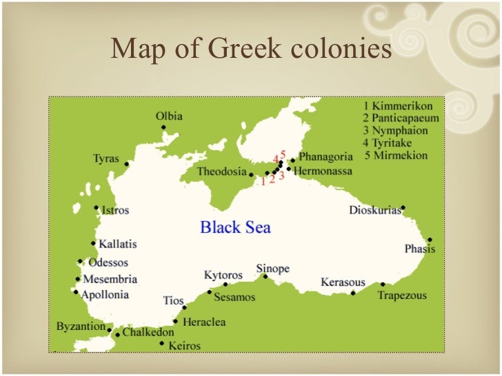
Kepoi (Κῆποι) was an ancient Hellenic colony situated on the Taman peninsula, three kilometres to the east of Phanagoria, in the present-day Krasnodar Krai of Russia. The colony was established by the Milesians in the 6th century BC. The Milesians were the inhabitants of Miletus, a city in the Anatolia province of modern-day Turkey, near the coast of the Mediterranean Sea and at the mouth of the Meander River. Settlers from Krete moved to Miletus sometime in 16th century BC. By the 6th century BC, Miletus had become a maritime empire, and the Milesians spread out across Anatolia and even as far as the Crimea, Olbia, Ukraine founding new colonies.

In the Hellenistic period, Kepoi was controlled by the kings of the Cimmerian Bosporus, the present-day Strait of Kerch. According to Hellenic historian Diodorus Siculus, the region was governed between 480 and 438 BC by a line of kings called the Archaeanactidae, probably a ruling family, usurped by a tyrant called Spartocus (438 – 431 BC), who was a Thracian.

At first the city, of mixed population, subsisted on farming and trade with Asian Hellenes and local tribes, paying taxes to the Bosporan kings. The inhabitants prospered from the wheat trade between the 4th century BC and the 1st century AD. The city was originally 20-25 hectares. It covered a small hill and extended down the slopes to the seashore.

The archaeological finds of the city are numerous. Soviet excavations, started in 1957, yielded rich finds. They include not only Klazomenai wares, Classical and archaic Attic bowls, terracotta figurines of local manufacture (4th century BC), imported Syrian glassware and Egyptian scarabs but also the remains of a house of the mid 6th century BC, and numerous graves from several necropoleis which can be dated to the same period. Other architectural remains date to the first century AD or later.

Stemming from the 1st century are ruins of a temple in antis dedicated to Aphrodite; the terracotta ex-votos found nearby represent the Goddess and was aptly names 'Aphrodite of Taman'. The statue is about half a meter high and dates to the first half of the second century AD. It's pictured above. Also found was a head of Aphrodite from a workshop near the Pergamon school, dating to the second century BC.

The remains of houses from this century reflect the high standard of living. The foundations are of stone, the walls of brick, often imported from Sinope as were the roof tiles; there are traces of water pipes. There are also remains of baths from the first century AD and two wine-making establishments dating to the first to third century AD.

The city of Kepoi reached its peak in the 1st centuries AD, but the Huns and Goths put an end to its prosperity in the 4th century. Since the 1960's, much of Kepoi has been explored and uncovered. The rest of the site has been submerged by the Sea of Azov and is out of reach for now.
Many people--myself included--sometimes forget how extensive the ancient Hellenic empire was. It wasn't just what is now modern Greece. It extended all the way down to, for example, Italy. Today: Cuma, or what the ancient Hellenes would have called Kumai.

[Temple of Zeus, was converted into a paleochristian basilica.
The baptismal font can still be seen in the back of the building.]

The ancient Hellenes had quiete a few names for it: Κύμη (Kumē) or Κύμαι (Kumai) or Κύμα (Kuma). It was an ancient city of Magna Graecia--the name of the coastal areas of Southern Italy on the Tarentine Gulf that were extensively populated by Greek settlers--on the coast of the Tyrrhenian Sea. the city was founded by settlers from Euboea in the 8th century BC and Kumai was the first Hellenic colony on the mainland of Italy. Its ruins lie near the modern village of Cuma, a frazione of the comune Bacoli in the Province of Naples, Campania, Italy.

The settlement is believed to have been founded in the 8th century BC by Euboean Hellenes, originally from the cities of Eretria and Chalcis in Euboea, which was accounted its mother-city by agreement among the first settlers. They were led by  Megasthenes of Chalcis and Hippocles of Cyme, according to legend.

The Hellenes built upon an earlier setting of indigenous, Iron Age peoples; a memory of them was preserved as cave-dwellers named Cimmerians, among whom there was already an oracular tradition. Its name refers to the peninsula of Cyme in Euboea. The colony thrived. By the 8th century it was strong enough to settle other territiories: Zancle in Sicily, and Triteia in Achaea, amongst others. It spread its influence throughout the area over the 7th and 6th centuries BC, gaining sway over Puteoli and Misenum and, thereafter, founding Neapolis in 470 BC. All these facts were recalled long afterwards; Kumai's first brief contemporary mention in written history is in Thucydides and it is also mentioned in Pausanias.

The growing power of the Cumaean Greeks led many indigenous tribes of the region to organize against them, notably the Dauni and Aurunci with the leadership of the Capuan Etruscans. This coalition was defeated by the Cumaeans in 524 BC under the direction of Aristodemus, called Malacus, a successful man of the people who overthrew the aristocratic faction, became a tyrant himself, and was assassinated.

The Hellenic period at Kumai came to an end in 421 BC, when the Oscans broke down the walls and took the city, ravaging the countryside. Some survivors fled to Neapolis and Kumai came under Roman rule.

Kumai is still the location of many finds and historic facts. The colony was the entry point in the Italian peninsula for the Euboean alphabet, the local variant of the Hellenic alphabet used by its colonists, a variant of which was adapted and modified by the Etruscans and then by the Romans and became the Latin alphabet still used worldwide today.

Kumai had an Acropolis with a temple of Apollon and one of Zeus. It is also the location of the Cave of the Sibilla, the oracular cave of the Kumaian Sibyl--prophetess. All can be visited to this day.